A GPX file is much more than just a digital trail. It's a promise of adventure: a signposted route that you just have to follow, on your phone or your GPS. All you need to do is choose the right application - and know that here in the Pays de Saint-Omer, dozens of routes are already available to download free of charge.
The GPX format (GPS Exchange Format) has become the universal standard for sharing routes. Lightweight, open and compatible with virtually all navigation applications on Android and iOS, all you have to do is download it and then import it into the app of your choice. Here are the best options depending on how you use it.
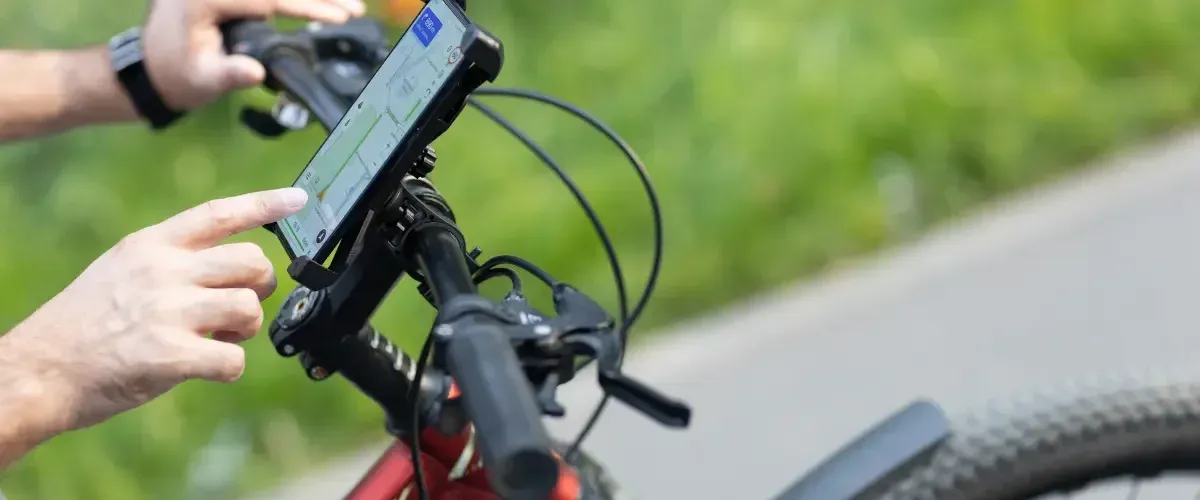
🚴 Cycling - Road, gravel & MTB
For cyclists, the essential thing is smooth navigation without stopping: turn alerts, altimeter profile visible in real time, and maps downloaded in advance for areas without a network.
Apps to remember:
- Komoot - The reference in Europe. One-click GPX import, voice navigation, detailed elevation profile. Offline maps by region. (Freemium)
- RideWithGPS - Very comprehensive for planning and navigating. Automatically generates cue sheets from GPX. (Freemium)
- Wahoo Elemnt - Ideal if you have a Wahoo computer. Strava synchronisation, simple GPX navigation. (Free)
Good to know: For mountain biking, Trailforks and Wikiloc offer tracks annotated by the community with the type of terrain and technical difficulty.
📍 All our cycling routes in the Pays de Saint-Omer - gravel, mountain biking and soft links, all downloadable in GPX.
🥾 On foot - Hikes, trails & long-distance crossings
The priority for hikers: accurate topo maps available without a network, and good battery autonomy. For one-day outings as well as major multi-day routes, the choice of app makes a real difference.
Apps to remember:
- OsmAnd - Based on OpenStreetMap. Impeccable offline topo maps, native GPX import. Free and open source. (Free)
- Wikiloc - Large library of community trails. Filtering by activity, difficulty and area. Reliable GPX navigation. (Freemium)
- Gaia GPS - Overlay of IGN layers, weather, GPX tracks. The most complete for demanding terrain. (Paid)
In France: The IGNrando' app integrates 1:25,000 maps with GR®, GRP® and PR® trails - a must for signposted hiking.
📍 All our walking routes in the Pays de Saint-Omer - from the marshes of the Audomarois to the hills of the Pays de Lumbres, all available in GPX.
🛶 On the water - Kayaking, canoeing, sailing & river navigation
On the water, the background map changes everything: bathymetry, locks, currents, tides. GPX remains the universal exchange format, but the application must offer a background map adapted to your environment.
Apps to remember:
- Navionics Boating - The world reference. Accurate marine and river charts, GPX import, marine weather alerts. (Chargeable)
- Paddle Logger - Designed for kayaking, SUP and canoeing. GPX tracking, session analysis, track sharing. (Freemium)
- OsmAnd + nautical plugin - For inland waterways: locks, bridges, ports on OpenSeaMap background. (Free)
For canals and rivers: Voies Navigables de France offers digital maps that can be downloaded from vnf.fr. For coastal sailing, Navionics or iSailor remain the professional standards.
📍 All our routes on the water in the Saint-Omer area - through the canals and watergangs of the Audomarois, in GPX.
🐴 On horseback - Riding and touring
Horse riding is the activity least well covered by consumer apps - but its needs are very specific: carriageable paths, watering holes, equestrian accommodation, and avoiding roads with heavy traffic. A number of tools have adapted to meet these needs.
Apps to remember :
- Trackcheval - Specialised French application. GPX equestrian tracks, location of accommodation and farriers, terrain reports (Freemium).
- Wikiloc - Can be filtered by "horse riding" activity. Good tracks on FITE and GRE (Grandes Randonnées Équestres) routes. (Freemium)
- OsmAnd - Displays bridle paths, country lanes and forest tracks. Ideal for avoiding the main roads. (Free)
Useful resource: The Fédération Française d'Équitation (FFE) references over 40,000 km of waymarked routes downloadable in GPX.
📍 All our horse riding routes in the Pays de Saint-Omer - equestrian itineraries suitable for riders of all levels.
🚙 By vehicle - 4×4, motorbike, camper van & road trip
Following a GPX in a car or on a motorbike is not classic GPS: the aim is to follow a precise route - off-road track, tourist circuit, secondary road - without the app "recalculating" towards the motorway at the first diversions. You need to choose an app that distinguishes between free navigation and strict tracking.
Apps to remember:
- Scenic - The benchmark for motorcyclists. GPX import, motorway avoidance, synchronisation with Cardo intercom, head-up display (Freemium)
- OsmAnd - Strict GPX tracking without recalculation, offline maps, vehicle profile settings. Ideal for 4×4 trails (Free)
- Overlander - Designed for off-road and motorhome use. Collaborative trails, water points, wilderness campsites, native GPX. (Freemium)
For motorhome users: Park4Night and iOverlander perfectly complement a GPX tracker by locating suitable areas - with bridge height, connections and user reviews.
📍 All our routes by vehicle in the Pays de Saint-Omer - roads and circuits to discover at your own pace.
In a nutshell: which app for which practice?
OsmAnd is the universal Swiss army knife: free, offline, compatible with all practices. Komoot dominates for cycling and hiking in Europe. For specialist uses, opt for Navionics for water sports, Trackcheval for horse riding and Scenic for motorcycling.
In all cases, a word of advice: download your maps and GPX files before you set off. In the Pays de Saint-Omer, the mobile network dead zones are often where there are the most beautiful paths.